Windermere to patterdale lake district england

3 min read

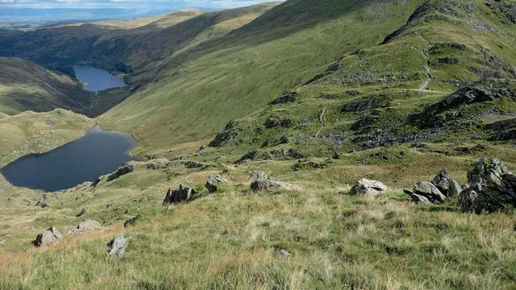
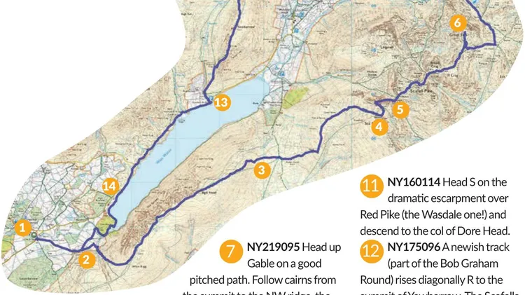
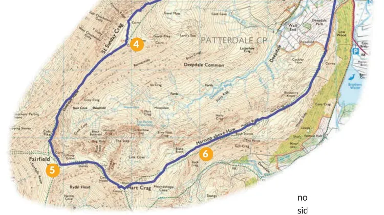
5 24.1km/15 miles/9 hours Ascent 1196m/3924ft

James Forrest ditches the car to tick off six Wainwrights

The summit of Orrest Head
Views of Ill Bell from the Kentmere ridge

IF YOU FANCY ditching the car, there are two main access points to the Lake District by train: Windermere (via Oxenholme) and Penrith North Lakes. With a long weekend, you could even walk between to the two stations on a three-day wild camping expedition with a twist. But if you only have a day spare, this 24km linear route is an excellent alternative.

Starting at Windermere, the route first climbs the 238m Orrest Head, where a young Alfred Wainwright first set eyes across Lakeland. After a linking section across farmland, next comes a delightful ridgewalk over the Kentmere fells, including the rolling Wainwright trio of Yoke, Ill Bell and Froswick, before picking up the ancient Roman road path over a further three Wainwright fells: Thornthwaite Crag, High Street and beyond to The Knott. The final stage descends via Angle Tarn and Boredale Hause to Patterdale, where the regular Stagecoach 508 bus will whisk you away to Penrith North Lakes train station to complete your rail journey home.

The huge columnar cairn on Thornthwaite Crag
The trio of Froswick, Ill Bell and Yoke on the Kentmere Horseshoe ridge

ROUTE

Start Windermere train station GR: SD414986

Finish Patterdale Hotel GR: NY395159

1 SD413986 Exit train station and turn left. Go past bus stops and Booths supermarket and turn right to cross road at zebra crossing. Turn right past bench and Windermere train station sign, and cross A591. Turn left, heading west. Fork right off main road and arrive at prominent white sign. Turn right and west on walled lane through woodland. Just before reaching sign. Continue north on winding path to reach right-hand turn in wall at Elleray Bank. Follow path as it bends rights, fork left almost immediately at next junction and climb steps heading east. Beyond gap in stone wall, continue east on wide gravel path. Ignore a turn-off left through gate and instead stick to wide path, which loops north-west and north to Orrest Head.

2 SD414993 Pick up a grassy path descending north. Next to gate, turn right over stone stile and head north and north-north-east footbridge, climb stone stile and turn right on road. Head north-east and east past Near Orrest. At left through gate and head north gates and stiles, turn right on Moorhowe Road and walk southeast to car park at Moor Howe. Turn left on Dubbs Road byway and head north to Dubbs Reservoir.

3 NY422016 Walk along eastern shores of reservoir and continue north. Ahead the going is straightforward, sticking to wide track. Continue north on wide Garburn Road track. Climb steadily as path veers north-east and, beyond the woodland at Garburn Nook, arrive at top of Ga

This article is from...

Related Articles

Related Articles