Beinn mheadhonach perthshire scotland

3 min read

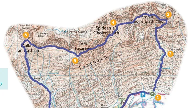
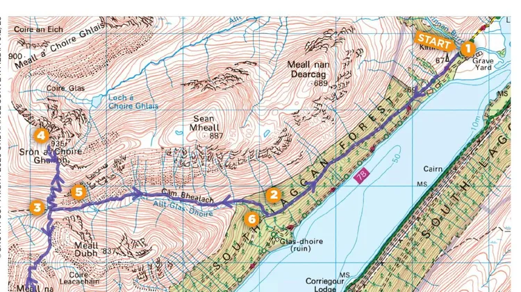
2 22.1km /13.7 miles /7-8 hours Ascent 974m/3196ft
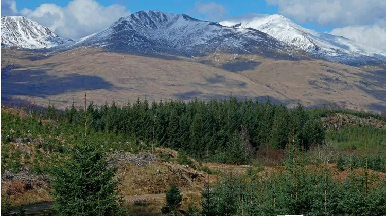
Alex Roddie jumps on the train to explore a Corbett above Blair Atholl

The cleared township of Ach Mhairc Mhoir
Approaching New Bridge and the start of the main ascent

ONE OF THE PLEASURES of getting to know a single area intimately over many years is that it soon stops being about the big attractions and starts being about the subtler charms. For me, the Blair Atholl area is a bit like that. I’ve been visiting regularly for more than a decade and still feel as if I’ve only just scratched the surface.

One of the reasons why I visit so often is that it’s very accessible by public transport – both train and bus. This made it a feasible base even when I lived down south in England. Now, based near the Angus Glens, I can easily head there for a day (or overnighter) by public transport.

Beinn Mheadhonach is a Corbett at 901m in height, tucked away between the Munros of Carn a’ Chlamain and Beinn Dearg. Approached through the delightful Glen Tilt, this is a straightforward hillwalk with good views and plenty of historical interest. Paths are generally good, although occasionally rough and heathery on the mid slopes.

The top-down view of New Bridge on the way back
Rocky summit terrain and hazy views to Beinn a’ Ghlo

ROUTE

Start/finish Old Bridge of Tilt car park GR: NN874663

1 NN874663 Start at the car park at Old Bridge of Tilt, which is a short walk through the woods from Blair Atholl. On the other side of the road, a track heads uphill through trees beside East Lodge. The track soon exits the trees and continues to gently climb with open pasture to your left. After about 1.6km, take the right-hand fork in the track and continue through woodland, soon descending to Cumhann-leum Bridge across the River Tilt.

2 NN881685 Cross Cumhannleum Bridge and keep going N (ignore a path coming in from your right soon after the bridge). Now on the E bank of the river, views begin to open up along the glen. Soon enter more woodland (Dalginross Wood) and descend to a second bridge (Gilberts Bridge).

3 NN881701 Cross Gilberts Bridge back to the W side of the river, turn right and continue N. The track passes through an area with several ruins before entering delightful open wooded pasture with mature birch trees dotted around. This is Sean-bhaile Wood, named after the cleared township of Sean-bhaile (not visible from the path). The track, fainter here, soon reaches Ach-mhairc Bridge – a far smaller, older and more picturesque bridge than the others, straddling an energetic waterfall. Cross the bridge to arrive in the ruined township of Ach Mhairc Mhoir.

4 NN888714 Extensive ruins can be explored on a slightly raised area above the main path. It’s thought there were originally up to 27 buildings; the community was clea

This article is from...

Related Articles

Related Articles